- Length: Approx. 11 miles
- Width: Approx. 2 miles (maximum)
- Shoreline: Approx. 65 miles
- Lake: 5,420 acres
- Watershed: 25,860 acres
- Maximum Depth: Approx. 85 ft. (New Milford)
- Average Depth: 29.3 ft.
- Waterfront Residences: Approx. 1,600
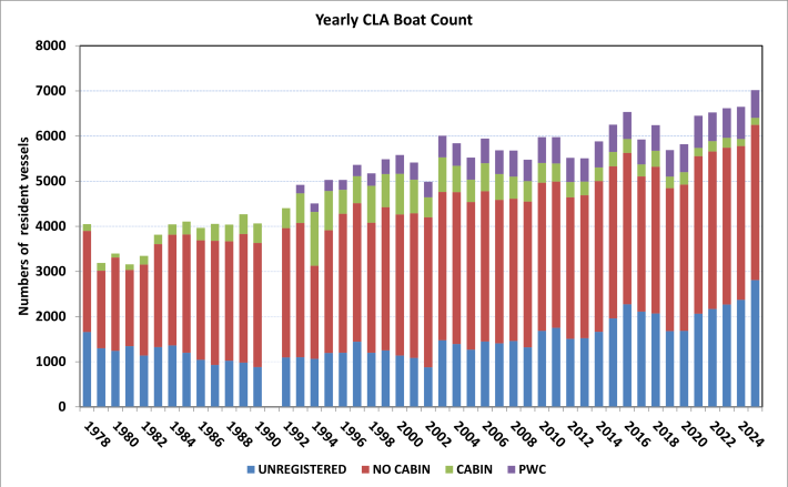
- Resident Vessels: Approx. 6,000
- Water Sources: Housatonic River, Sawmill Brook, Ball Pond Brook, other small brooks and springs
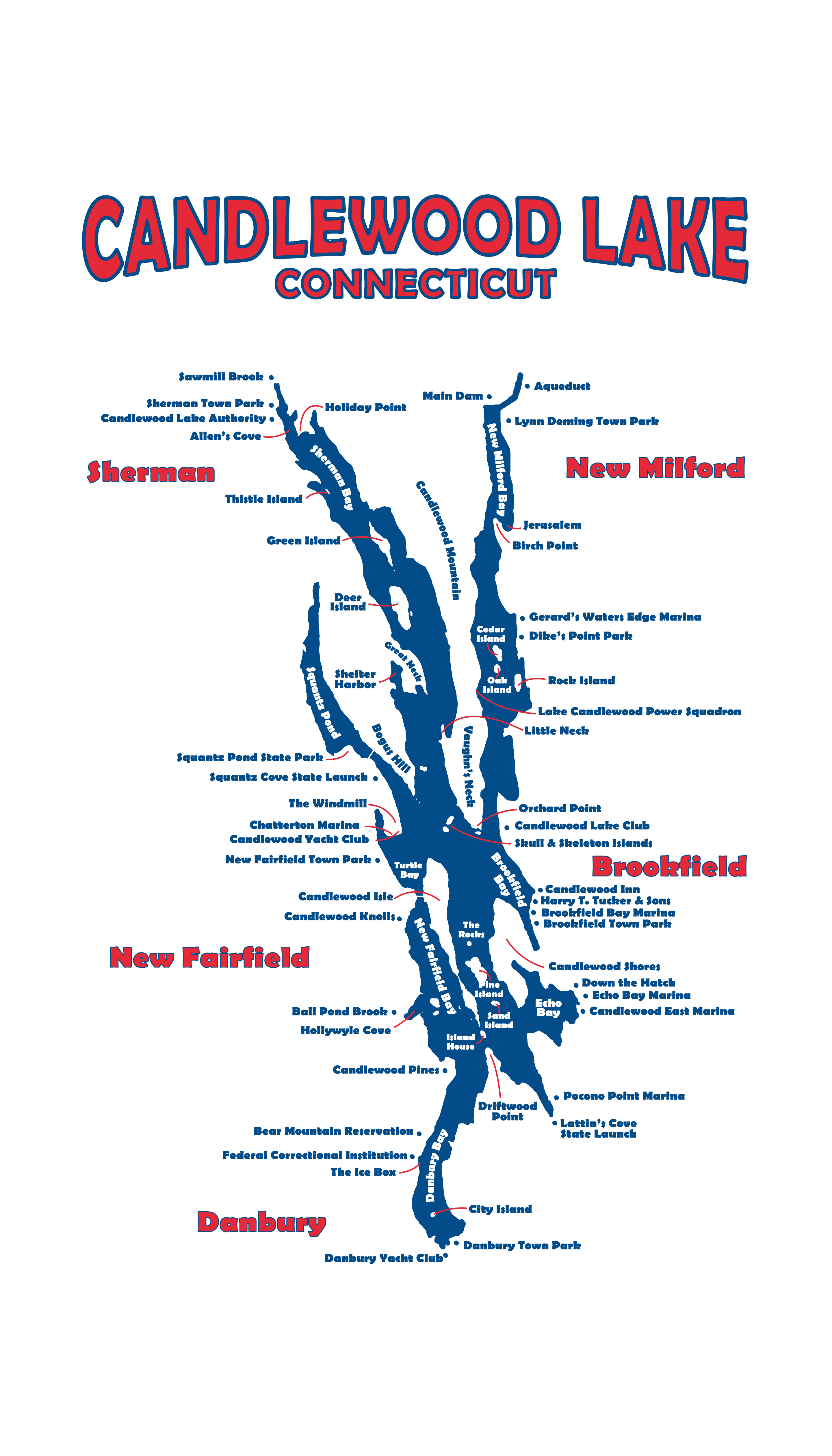
- Shoreline Municipalities: Towns of Brookfield, New Fairfield, New Milford, Sherman and the City of Danbury
- Lake Level 24 Hour Phone Line: 888-41-RIVER (74837)
- Boating Emergency 24 Hour Number (CT DEEP Dispatch): 860-424-3333
- Full pond: 429.5' elevation
- Shoreline Municipalities: Towns of Brookfield, New Fairfield, New Milford, Sherman, and the City of Danbury
- The Rocky River and Candlewood Lake Project created the lake by damming the Rocky River and flooding the local valleys. The 26-month project was completed on September 29, 1928.
- The lake is owned and operated by FirstLight Power as a hydro-power facility licensed by the Federal Energy Regulatory Commission.
- Water pumped up from the Housatonic River to Candlewood Lake at full operational capacity: 3,700 gallons per minute
- Water pumped into the Housatonic River from Candlewood Lake to generate electricity at full operational capacity: 15,500 gallons per minute
- Public Boat Launches controlled by the state Department of Energy & Environmental Protection (DEEP): 2 on Candlewood and 1 on Squantz Pond
- Municipal Beaches: 5
- Over 150 fishing tournaments are held annually